06/19/18

How To Access Bwindi Impenetrable Forest National Park?

There is nothing more stressing than getting lost while on your way to your dream destination. Imagine you are on self drive safari or even guided tour to Bwindi Impenetrable Forest National Park and along the way you drive for kilometers off road and only to be told that you got lost. Not only can this be a waste of time but also a waste of money a fact that fuel will be consumed to return to the right route.

Bear in mind that there is no one who is perfect on the road so, if you are planning to spend your next vacation in the splendid Bwindi National Park, there is need for you to be well versed with different routes. This park is located in southwestern Uganda and it is about 8 to 10 hours’ drive from Kampala which also 46 kilometers from Entebbe International Airport that is a major entry point to Uganda. If you are planning to spend a holiday in this park, you will need at least 3 days and more a fact that you will spend an entire day driving from Kampala and the next day will be for you to engage in various activities at the park.

However, if you are from the neighboring Rwanda, 2 days are enough to get to Bwindi and take park in the gorilla safari adventure. This route is from Kigali Airport to Kisoro town through Cyanika boarder or Kabale town through Gatuna boarder.

Bwindi National Park can be reached by road and air. If you opt to drive, you will choose among the many routes that take you up to the park. If you are at Queen Elizabeth National Park for a tour, you can drive from Mweya to Bwindi approximately 160 kilometers’ drive and you will spend at least three to four hours driving. Equally, you can start your safari from Kampala to Kabale via Kanungu to Buhoma area and this is tarmac route and covers over 414 kilometers.

The other route also starts from Kampala to Ntungamo to Rukungiri and then to Buhoma area approximately 390 kilometers’ drive on tarmac and 82 kilometers on murram route. You may as well as set off from Kampala to Kabale to Ruhija to Buhoma about 95 kilometers and the other begins from Kampala to Kabale to Nkuringo sector.

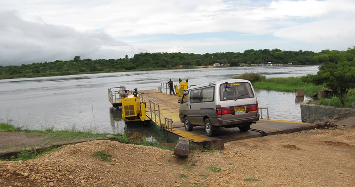
Alternatively, you can use a bus from Kampala to Butogota where you will rent a taxi that will connect you to Buhoma sector. However, you won’t find a public transport means at Nkuringo but there are some cars for you to rent around Kisoro and Kabale towns. But to be on safer side, it is better that you plan your vacation with a recognized travel agent which is well versed with routes and attractions for you to enjoy along the way.

For those of you who have short time in Uganda, then a flight is the best option for you. You can take a flight from Entebbe International Airport and Kajjansi Airfield and then land in Kisoro or at Kayonza airstrip if you are to track gorillas in Buhoma area.

If you are tracking gorillas in Southern Bwindi National Park (Nkuringo or Rushaga sectors), then you fly to Kisoro airstrip. Aerolink Uganda offers daily scheduled flights from Entebbe International airport to different airstrips in Uganda such as Kihihi, Kisoro, Pakuba, Apoka and Bugungu among others. There are also charter flights offered by Kampala aero club.

06/11/18

Ruzizi River in Rwanda

The beauty of Rwanda is not only mountain gorillas, the big five animals, antelopes and bird species but also the numerous water resources including Lakes, Rivers and waterfalls that have remained unexplored because few tourists know about them. If you ask anyone to mention some of the common rivers in Rwanda, you will surprisingly not hear about the Rusizi River yet it’s one of the most beautiful water resources in the country.

This 117-kilometer long River is sometimes spelled “Rusizi” and flows from Lake Kivu to Lake Tanganyika in Central Africa while descending from about 1500 meters/4900 feet above sea level to only 770 meters/2530 feet above sea level over its length. The river drains across three countries-the Democratic Republic of Congo, Burundi and Rwanda but its source is in Lake Kivu and mouth in Lake Tanganyika. The most perpendicular bank of the River occurs over the first 40 kilometers (25 miles) where hydroelectric dams were constructed. When getting closer to the mouth, the Ruzizi Plains (the floor of the western Rift Valley are surrounded by gentle hills making the river to flow into Lake Tanganyika through a narrow delta with one or two tinny channels breaking off from the main channel. The Ruzizi River has several tributaries that include Rubyiro, Luvungi, Muhira, Nyakagunda, Ruhwa, Kaburantwa, Nyamagana, Mpanda, Kagunuzi and many others.

Formed about 10,000 years ago through volcanism that led to continental rifting and creating of Virunga Mountains, the Rusizi River is considered a young river. The Virunga Mountains blocked part of Lake Kivu’s outlet to the watershed of River Nile, hence forcing the Lake to overflow southwards down Ruzizi and the watershed of the Congo River. Along its course, the river forms the border between Rwanda on the East with Democratic Republic of Congo on the west but as it continues downstream, it also forms part of the boundary between Burundi and the Democratic Republic of Congo and its lowermost part flows completely within Burundi.

To the west, the magnificent Fizi Baraka Mountains stand over the river while the Bridge of Concord, Burundi’s longest and widest Bridge crosses the River close to its mouth.

Flora and Fauna within and around Ruzizi River

Ruzizi is not just a river as you may see it but an important habitat to the prominent, notorious and widely publicized man-eating crocodile known as “Gustave” that usually wanders around the banks of the river as well as the northern shores of Lake Tanganyika. This giant savage is said to be about 6 meters (20 feet) long and reportedly weighs over 900 kilometers (2000 pounds). In the 1950s, the banks of this River were inhabited by common warthogs, buffaloes and elephants but today, there are only Nile crocodiles and Hippos.

The lower banks of the main river and its tributaries are covered by reed swamps and there are riparian swamps of about 3 kilometers wide are found near the mouth while further from the river, there are grasslands especially in the lower river valley. The general vegetation of the River basin is mostly savannah grassland with scattered acacia, eucalyptus and oil palm. Ruzizi River is only 353 kilometers from Kigali City (Rwanda’s Capital).

06/11/18

Top Hiking trails in Uganda

Hiking is a typical adventure experience in Uganda that is quite unique & interesting for anyone to get involved while on a vacation.

  • Hiking to Margherita Peak.

Mountain Rwenzori is a world heritage site that otters the opportunity to see nature and its best. Due to its numerous peaks with the highest peak at 5,109 meters which is Margherita.

Margherita is the highest peak of mountain Rwenzori. It’s the third highest mountain in the whole of Africa. It has a unique, fantastic and a true beauty that offers unremarkable hiking experience in Uganda with clear view of eastern DR Congo when on top.

Margherita is the third highest peak in the whole of African and the highest in Uganda; its real beauty with the climb up through Kilembe route, the forest ,valleys and the diversity of flora and fauna gives a tourist unforgettable experience.

Hiking is one of the best activities that Margherita offers to all the visitors who are interested in testing their physical fitness.

Hiking to Margherita peak take a couple of days, between 7-9 days according to the physique and speed of the hikers. Though the hike involves unique activities like walking through the forest, climbing the rocks, viewing birds and the animals that can be spotted within the Montane forests, for pleasure and exercise, starting from Kilembe up to the top of Mt. Stanley where the highest peak Margherita can be sighted.

Hiking Mountain Rwenzori down slopes via Bwamba pass inBundibugyo. Before a road was built in 1938 to link fort portal with the remote town of Bundibugyo, local people followed the most direct route between these settlements -a tough 1500m high trek over steep north Rwenzori ridge, known as the Bwamba pass. The Abanya Rwenzori community group leads the hikers over the mountain through isolated mountain villages to visit the bamboo forest and enjoy superb rift valley views.

  • Hiking on Mount Elgon.

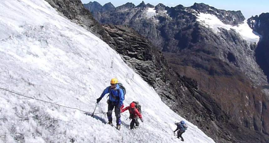
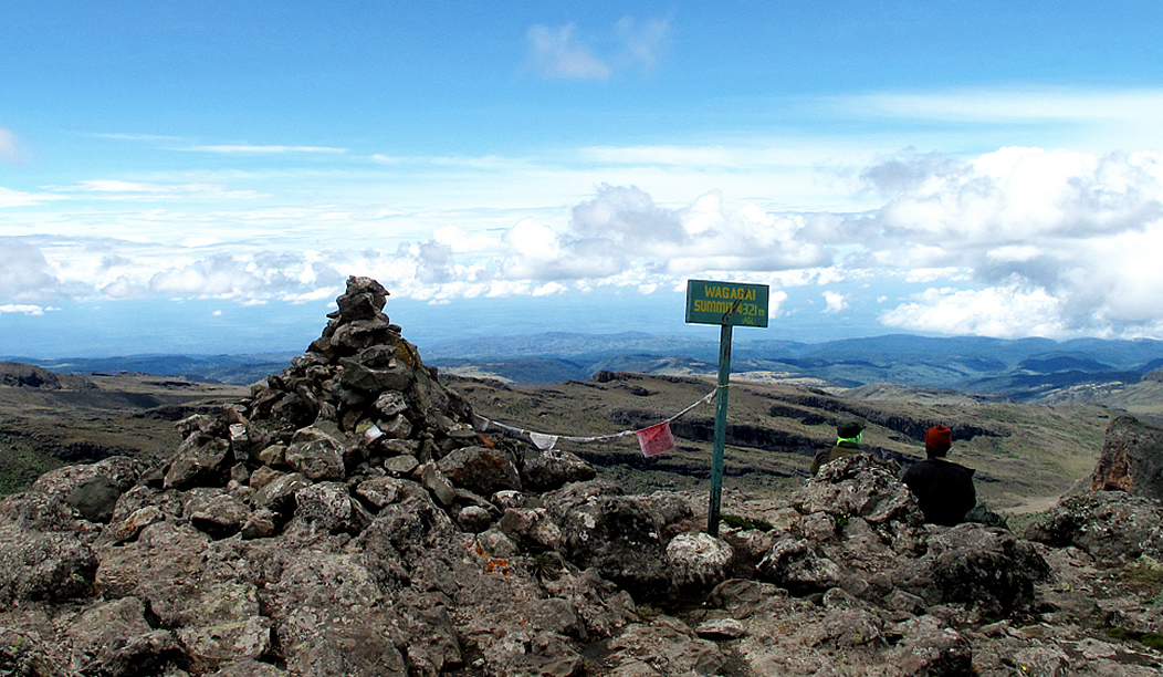
Mt. Elgon lies at an altitude of over 4000m above sea level with the largest volcanic base in the world. Located on the Uganda-Kenya border it is also the premier and largest solitary, volcanic mountain in East Africa. Its vast form, 80km in diameter, rises more than 3,000m above the neighboring plains. The mountain’s cool heights offer respite from the hot plains below, with the higher altitudes providing a safe haven for the growth of flora and fauna.

This conservation area is a habitat of over 300 species of birds, including the endangered Lammergeyer, mammals including Small antelopes, forest elephants,monkeys and buffaloes which dwell on the mountainside.

A hike on Mt. Elgon’s deserted moorlands discloses a magnificent and un-clustered wilderness without the summit-oriented approach common to many mountains: the ultimate goal on reaching the top of Mt. Elgon is not the final ascent to the 4321 m Wagagai Peak, but the descent into the vast 40 km² caldera.

  • Hiking in Semuliki valley

In Semuliki national park there are 3 hiking trails, Kirumia trail and this runs through the heart of the forest to Semuliki river and this one is really perfect for birders, red monkey trail goes to the park’s eastern border and in this place your assured to view the rare deBrazza’s monkey, Sempaya trails and in this trail u will view the male hot springs and female hot spring, dominated by boiling geyser. Eggs and Matooke (green plantain) can be cooked in these boiling waters and enjoyed by hungry hikers.

  • Hiking Muhabura Mountain.

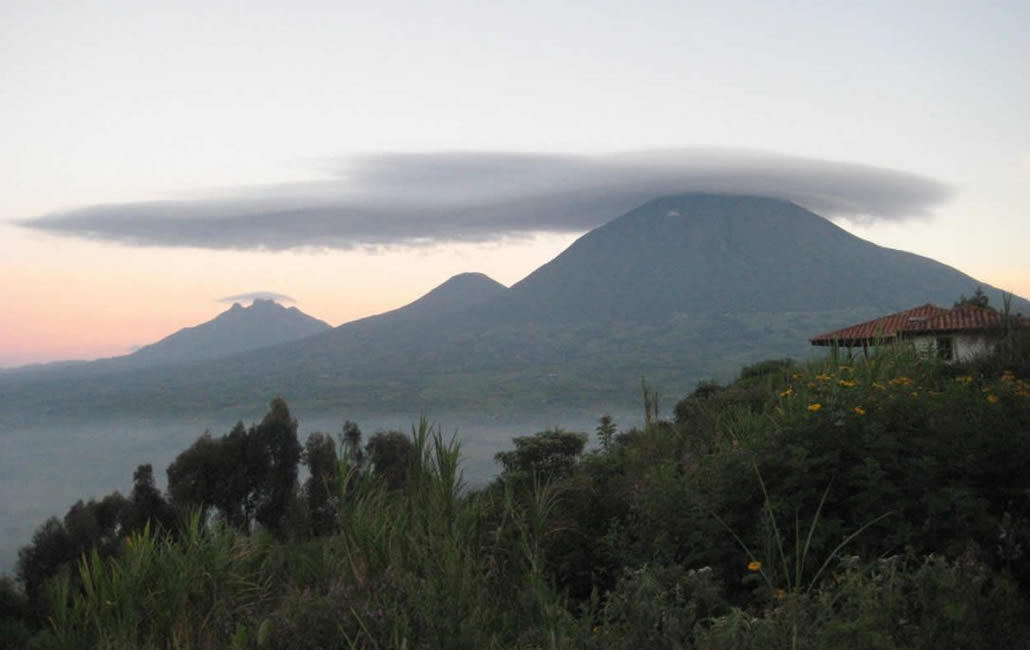
This is an extinct volcano found in Kisoro, and one of the Virunga Mountains, lying across the border between Rwanda and Uganda. It’s the third (3rd) highest mountain of the eight major mountains in the Virunga ranges reaching up to 4,127m (13,540 feet).
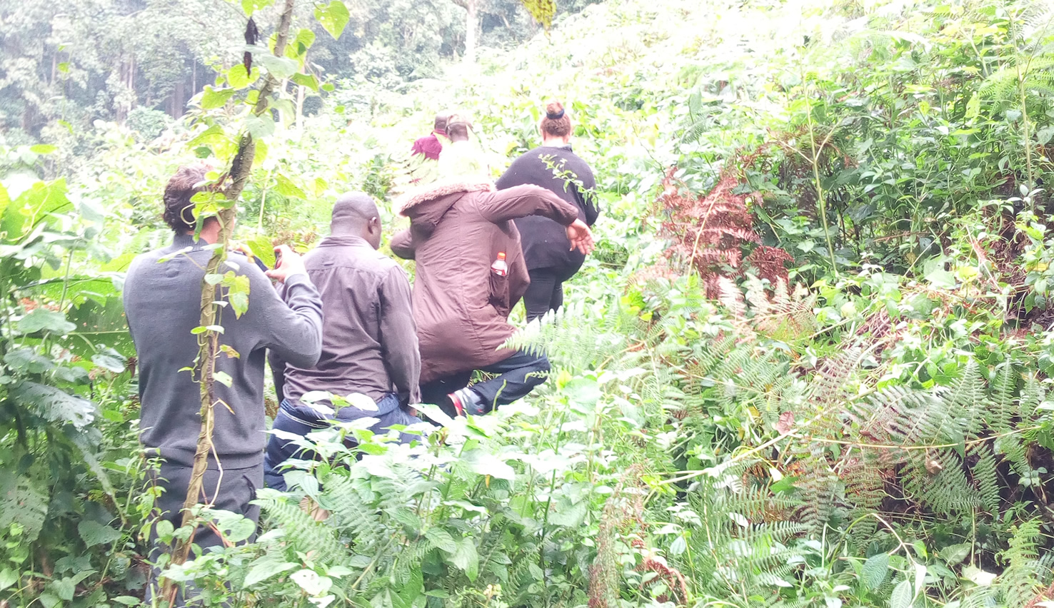
Hiking Mt Muhabura in the south western Uganda is so adventurous and the place is worthwhile visiting to enjoy such amazing hike on this mountain. It feels great walking through the beautiful varying terrains that often looks like a desert, viewing at the open slopes; you see a beautiful cover of thick shrubs and thickets of a broad spinned of evergreen plants.

  • Other hiking opportunities in Uganda’s national parks.

Hiking in Lake Mburo national park is at Rwonyo, a trail leading to salt lick where many animals are attracted to salty rocks.

Walk on the western side of the lake, and encounter hyenas returning to their dens and hippo retreating to the lake. Hikes via the woodland in Lake Mburo gives you a chance to sight birds, mammals, and walking to the top of the hill rewards hikers with a spectacular view of the region’s 14 lakes.

Hiking through the jungles of Mgahinga Gorilla Park to the low Mount Sabinyo gorge-a heavy gash on the side of mount Sabinyo, gives excellent birding opportunities and the chance to find the rare Rwenzori turaco. Trekkers can sight the calderas on top of the Gisozi hill, look out for Kisoro, Bunagana town and be captivated by Lake Mutanda.

Hiking through woodland to the top of Murchison falls is completely different experience of this magnificent waterfall. This is an experience that brings all the sense into play; waves of white water fall hypnotically through this 6 meter gap, listen to loud sound, taste the spray on your face and feel the rock shake beneath your feet.

Hiking on Mweya peninsular offers savannah and woodland with beautiful views and bold warthogs. On the southern end of park, hikers can enjoy an easy stroll along Ishashaa river, where they can spot a variety of forest and savanna bird and mammal species as well as having a unique opportunity on this hike to get extremely close to hippos on foot, while remaining safe on the raised bank above the river.

06/10/18

Closure of Tourism in Virunga National Park Congo 2018

Virunga national park has for years been battling with political strife and civil insurgencies and hostility from resident rebel groups in the forest. However with the recent peace and calmness in the region, tourism had gradually picked up and the park was flourishing once again in many years. However the kidnappings of May 11th posed yet another great state of insecurity towards travelers as never before, making it the first ever direct attack targeting the tourists.

Virunga National Park

In a similar manner, 6 park rangers were robbed of their lives while on duty in the park’s most remote section when they fell in an ambush of purported militia rebels, known as Mai Mai who are known to reside in this forest.

The park authorities have then considered suspending and halting all tourism activities in Virunga national park following the 11th May kidnap of 2 British tourists, driver and the park ranger who was later killed.

The Virunga park authorities announced the indefinite suspension 3 days later after release of the tourists on 15th May 2018; however reports on when the park will reopen are still undisclosed as security conditions still remain fragile.

The kidnaps took place on Friday 11th May 2018 in the Nyiragongo territory, north of Goma and the female ranger aged 25 was shot and she died shortly after admission in a nearby hospital.

The U.S State Department listed D.R. Congo at Level 3 on their four – level travel advisory list, advising American travelers to “reconsider travel” to the central African country due to “crime and civil unrest”.

Gorilla Family Virunga Park

All travelers who had booked their trips to Virunga national park are urged to get in touch with their booking agents and discuss alternative journey or cancellation will full refund. Many travel agencies have already offered refunds to clients who considered cancellation, while others are offering alternative trips to the neighboring Uganda and Rwanda for gorilla trekking and wildlife tours.

This unexpected closure removes Virunga conservation area, one of Africa’s premier and oldest treasures from the travelers’ list. In 2014, its southern section was the first to be reopened to travelers, however security has never been fully guaranteed as rebels have continuously showed up on different occasions.

Groups of armed militia known as Mai-Mai still operate in the park’s interior, exploiting its water bodies, forests, and wildlife. Five rangers and their driver were killed in a single attack by these militia groups earlier this year in April.

Virunga National Park, also known as Parc national des Virunga is a popular protected area and Africa’s oldest and largest national park, which covers 3,000 miles, located in the Virunga region and home to an extended chain of 8 mountains spanning Uganda, Rwanda and D.R. Congo. This park is a significant conservation area which shelters more than a quarter of the world’s endangered mountain gorillas and the eastern lowland gorillas, buffaloes, elephants and abundant bird-life.

Sliverback Gorilla in Virunga Park – DRC

Virunga national park has seen a rise in her visitor population since 2004, and for 4 years since it was reopened the numbers have been growing magically from almost none to 100,000 last year.

As a result, the park now funds its annual running costs typically from tourism revenues which amount to $10m and this covers 6 aircraft, a rapid-reaction force, 800 rangers, intelligence operation, 24 hour operation Centre and canine unit.

Travel risks in Virunga national park.

In the recent past, Virunga national park had gained significant popularity and stability, but resistance and threats posed majorly by poachers and militia groups whose target are park rangers have failed to seize.

For the last 20 years, a total 170 rangers have lost their lives in the hands of either militia groups or by poachers.

Currently, poachers are still active in the park, charcoal industry who felly trees and those interested in oil exploration.

Travelers remain vulnerable if moving without escorted transportation in region of Goma and other parts of Eastern D.R. Congo and the “risk of injury and kidnap as a result of armed groups and criminal activity remains high”.

06/10/18

F.A.Q: Self Drive Rentals In Uganda

The Frequently Asked Questions About Self Drive Rentals In Uganda

A self drive safari also famous as self guided safari is a remarkable road trip that involves some one to hire a vehicle to help him or her transverse through Uganda’s roads on own his or her own without any guide but with a GPS and  may be guide/travel books / Maps. The freedom and privacy the self drive safari gives visitors is exceptionally one of the remarkable adventures that come once in a lifetime. This gives opportunity for you catch a glimpse of abundant wildlife and indigenous tribes within a shortest time possible. They range from the rare mountain gorillas, the big five game to the stunning tropical rain forests, landscapes and several water bodies, and if you are adventure enthusiasts and nature lover, Uganda is such a remarkable destination that is worthy visiting. Prior planning a self drive tour in Uganda, we have listed a number of questions that commonly asked by various visitors in their initial planning states;

 How old do I need to be to hire a vehicle in Uganda?
Provided that you are above 20 years with a valid driving license /permit, you are free to rent a car for self drive trip in Uganda. At least have about four years driving experience in case you need to get on the road on self drive to catch a glimpse of many tourist attractions in the country.

How do I book a vehicle?
Booking a car in Uganda can be done through online by filling in the short form or simply send an email directly and the other alternative is for you to book by visiting the company’s office itself.

What is the cheapest vehicle for self drive in Uganda?

A self drive safari in Uganda is best when you take a 4×4 safari vehicle that can navigate through the terrains and all kind weather conditions in the remotest areas where most attractions are found in the country. You can make your choice along Land Cruiser Prado, Safari Land Cruiser, Toyota Rav4, Nissan Patrol, Super Custom and Safari Minivan.

Why go on self drive trip in Uganda?

A self drive tour in Uganda gives visitors that total freedom, flexibility and convenience to make any decision on where they want to visit and what they wish to view and explore at their own time.

Can I pre book or book a car up on arrival?

By pre booking a vehicle for safari you stand to get some benefit of purchasing power. Rates for self drive car hires are minimal and fit within the visitors pocket range. It is better to pre-book in advance to avoid disappointments at the last day.

Do I need an international driving permit?

An international driving permit is a proof that you have a valid license in your home country at the date of issue of the IDP. This should come along domestic driver’s license.

Do I require any travel insurance?

You need to take travel insurance and it better for safari holidays in Uganda. This will cover issues of accidents or theft of the cars.

Where do I pick up the rental car?

Visitors can pick a car rental at agency offices, airport or any other specific place that will be agreed upon booking. A driver and representative from car hire company will deliver the vehicle within the shortest time possible and once you land in, you simply walk in and you will be handed over the keys to start your ride.

Can I drop off the vehicle at different location?

Yes, you can drop the car to another location but must be agreed on with the car rental company, and some times, this happens at a fee. For example, if you started your trip in Kampala and you want to drop the car in Mbarara, you will be charged for fuel and driver to return the car to Kampala. This fee is negotiable between the hirer and car rental agency.

What car hire fuel types are there?

We have petrol and diesel fueled vehicles and you choose the one which is best for you. The rates also differ based on the fuel type.

What is the fuel policy for hiring the vehicle in Uganda?

Most car rental agencies like 4×4 Uganda Ltd and Rental Cars Uganda Ltd offer quarter tank vehicles and expect it to be returned to us in the same way and if the vehicle is brought back when it is less than quater tank, you will incur an extra cost to repay for the missing fuel capacity. And there is no refund for unused fuel. Self drive cars offered depending on unlimited mileage meaning that you visit the area provided you incur the cost of fueling the car yourself.

What if I brought back the vehicle late?

In case you brought the vehicle some hours late on the last day, you won’t be charged by most car rental companies in Uganda but in case you make a mistake of bringing it a day after, then expect an extra cost for the similar amount that you paid each day. We encourage our visitors to always contact our reservations group and let them aware about your interest the number of car hire days as you may even get some discount on it.

In conclusion, when it comes to car hire services for self drive safaris in Uganda, we offer variety of cars within visitors travel interest and we able to respond to any other inquiries a visitors would like to get clarification. Enjoy your trip.

06/9/18

What to see and do in Akagera national park?

Situated in the Eastern province of Rwanda, Akagera national park is Rwanda’s hidden jewel, which reward travelers with a huge chance to experience wildlife from very close by. Covered with beautiful green savannah grasses, a safari to Akagera national park is an exceptional experience which reward travelers with the most beautiful and heart-warming experience of meeting and interacting with a variety of wildlife and birdlife. Despite its small size Akageranational park offers it all to meet and exceed every travelers expectations. The national park was named after river Akagera that flow in the heart of the park.  Despite the less visits to Akagera compared to other savannah national parks in the neighboring countries, a safari to Akagera national park is unique is an exceptional experience.

  •  Game viewing

Interestingly, Akagera national park is now a home for the big give game hence the best spot for game viewing. A game drive in the open savannah reward you with spectacular views elephants, lions, rhinos, buffalos, Leopards, giraffes, Topis, bushbucks, Topis, Zebras, Defessa waterbucks, baboons, Vervet monkeys, giraffes, oribis, roan antelopes, sables, reedbucks and kobs among others browsing and hunting before going to rest. The best time for game driving is early morning hors to catch u with early risers and early evening before animals for rest in the night. Interestingly, night game drives are also done in Akagera national parkproviding travelersachance to see nocturnal animals such as bush babies, bat eared fox, wolves among others as well as enjoying nightlife in the wild.

  • Bird watching

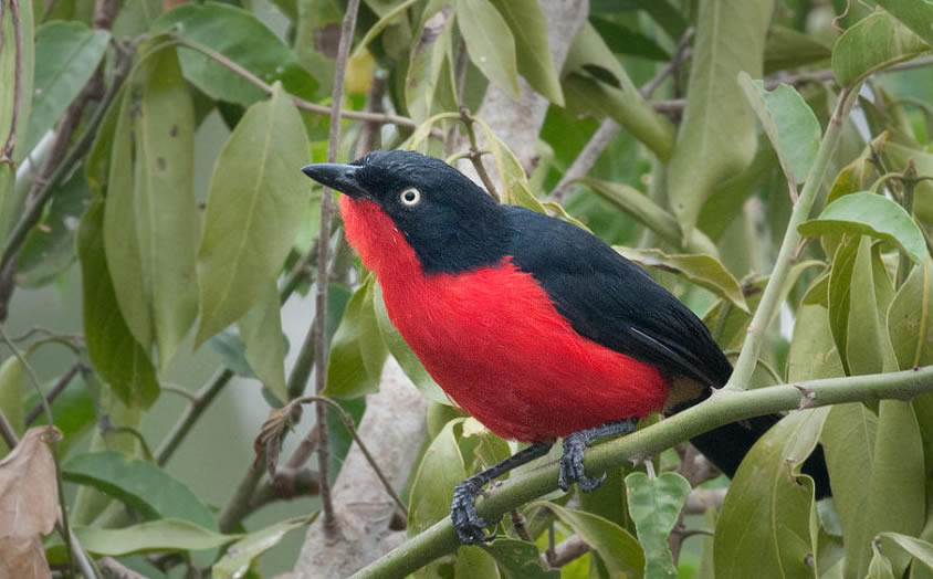
Besides wildlife, Akagera national park isa best spot for bird watching. The national park is a home to over 520 bird species some of which are endemic to the area hence a golden opportunity for travelers to see theserare bird species. Expect to see white-collared Oliveback, red faced barbet, Sousa’s shrike, Black headed Gonalek papyrus canary, Serinus koleinsis, saddle-billed stork, Fork railed drangoross’s turaco, African fish eagle, herons, Egrets, Crested barbet, open billed stork Marabou storks, Robinchat, African fish eagle. Birds are mostly seen in the swamps, forest areas and on the shores of lake ihema especially during a boat cruise. Travelers are reminded to come along with binoculars, which help to spot birds even a far distance.

  • Camping

Camping is yet another interesting activity donein Akagera national park and it is one of the unique activities that make the national park exceptional worth visiting. In camping, tents are built in a certain place for travelers to enjoy a night in the middle of the bush providing them with a closer encounter with wild animals and is a best way to explore all that Akagera offers. Presently, three campsites, which are Shakani Akagera campsite on the shores of lake shakani, Mutamba akagera campsite and Muyumba campsite at the ridge.

  • Boat cruising

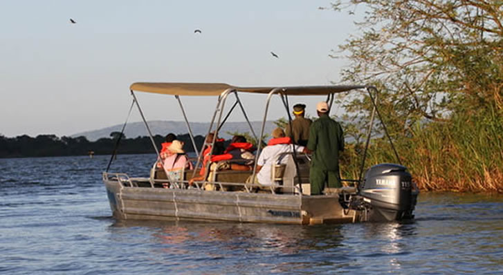
Done on lake ihema, boat cruising is a not miss on your safari to Akagera national park. The ride at the lake rewardyou with great views of hippos, buffalos, crocodiles on the shores which experience cannot be got else where in Akagera national park. Additionally, expect to see a variety of birds such as shoebill stork, fly egrets and red-billed stork among otters. More still, a boat cruise provide you with a fresh feeling of  fresh airs as well as spectacular views of the neighboring communities. Boat cruising is mostly done in the afternoon hence a best way to relax and chill.

  • Sport fishing

Sport fishing is one of the interesting games done in Akagera national park. Travelers take part in a“catch and release fishinggame’, which is surely enjoyable. Sport fishing is doneon lake shakani and lake ihema at a cost of 20$ for the people who help in fishing. Travelers go along with other fishermen who use different fishingmethods such as hooking, gill nesting, spearing andshooting method, cast net method, scoop net method and lampara method are used to catch fish by different people of different occasions. As part of the experience, travelers are expected to catch a live fish and release it back into the water.

  • Cultural encounters

Since Akagera national park is managed in partnership with the local communities, travelers are blessed to meet andinteract with local people. It’sinteresting that some part of the national parkwas dedicated to local people who do their cattle grazing which feed with other wild animals. Travelers take part in cattle grazing, milking and other local activities such as milk preservation, as well as make milk products such as ghee, butter and yogurt among others. This make the feel as part of the local community providing them with extensive understanding of how community traditions and norms.

Book a safari to Akagera national park, take part in the activities, see all attractions rewarding you with a life changing experience.

06/5/18

Nabajjuzi Wetland in Uganda

This Ramsar wetland is situated in Central Uganda within Masaka district, approximately 120 kilometers south-west of Kampala City and currently encompasses a linear swamp on the floor of the Nabajjuzi River Valley.

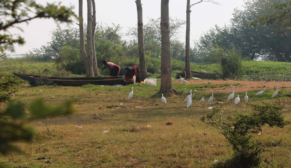
Nabajjuzi covers an area of 21.44 square kilometers (2144 hectares), has an elevation of 1200 to 1300 meters above sea level and stretches north-wards along the Nabajjuzi Valley for 40 kilometers from Masaka Town to its confluence with the premier swamp of River Katonga that flows into the vast Lake Victoria, hence making Nabajjuzi one of the tributaries if the Katonga River basin.

Vegetation of Nabajjuzi wetland

The Nabajjuzi wetland is mainly characterized by cyperus papyrus and dotted by Miscanthus violaceus while the small open water pools allow the growth and survival of the Nymphaea nouchali var. caerulea. This area is characterized by Cyperus papyrus dotted with Miscanthus violaceus in majority of the parts of the wetland, the interior of the wetland supports communities of Kostchya, a common shrub in this kind of Papyrus swamp while the margins have Cyperus denudatus, Alchornea, Pennisetum purpureum and phoenix reclinata and many others.

Even with the long history of resources being extracted by the surrounding local communities, some areas of this wetland have remained relatively intact and authentic with the flora and fauna species as it used to be in the past. It is obvious that the growing use of wetland products for subsistence and commercial use has contributed to the increased levels of harvesting and several surrounding areas have been modified and developed into trading centers and small Towns which has in turn increased the demand for the wetland recourses hence over exploitation.

Attractions within Nabajjuzi wetland

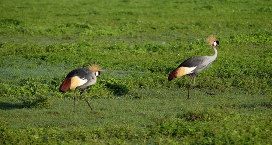
The Nabajjuzi wetland offers shelter to several mammal species including the sitatunga, a swamp-dwelling antelope that is globally threatened and specie of national importance. Additionally, the wetland is an Important Bird Area sheltering several threatened and vulnerable bird species such as the Papyrus yellow warbler, shoebill storks and the Papyrus Gonolek but is also a home and breeding zone for the exceptional Grey crowned crane, Uganda’s National Bird.

Mud fish (Claris mossambicus) and Lungfish (Protopterus aethiopicus) are some of the extraordinary fish species that call the Nabajjuzi wetland home, and the fish are the main source of protein for the local communities around the wetland and Masaka district in general.

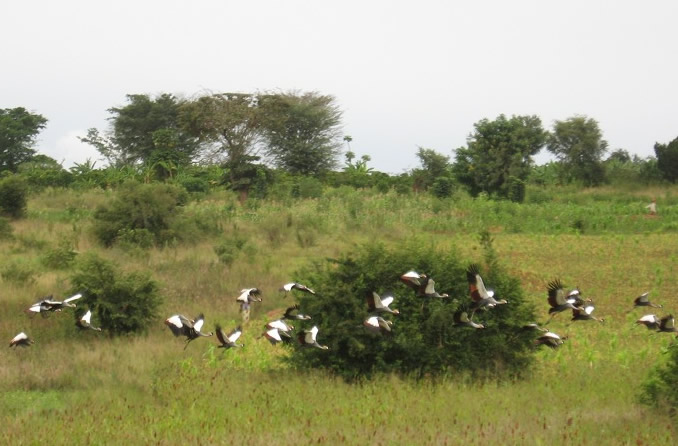
Besides the exceptional attractions, Nabajjuzi wetland is the main source of piped water for the people of Masaka Town but one of the challenges is the nearby tannery that discharges effluent into the wetland which is less than 400 meters from the water extraction and treatment plant. However, the high population around the southern part of the wetland is mainly characterized by the sub-urban residents of Masaka district and the other Townships whereas the communities in the northern part are mainly rural with subsistence lifestyles but both communities depend deeply on the water from the site with the latter using the wetland for grazing but also harvest several swamp products for medicine, thatching and crafts.

Nabajjuzi wetland is found within the native Buddu County, one of the popular counties within the large and culturally blessed Buganda Kingdom and most of the fauna and flora species here are attached to the cultural norms and traditions, especially totems of the people of Buganda.

06/2/18

Lake Edward & The Kazinga Channel

Also referred as Edward Nyanza or Rutanzige and traditionally as Mwitanzigye (killer of locusts), Lake Edward is considered the smallest of the many African Great Lakes and is situated within the floor of the Albertine Rift Valley region, the western arm of the Great/East African Rift that lies on the Uganda-Democratic Republic of Congo border overlooking the legendary Mountains of the Moon (Rwenzori Mountains) with the highest snow-capped peak rising to 5109 meters above sea level.

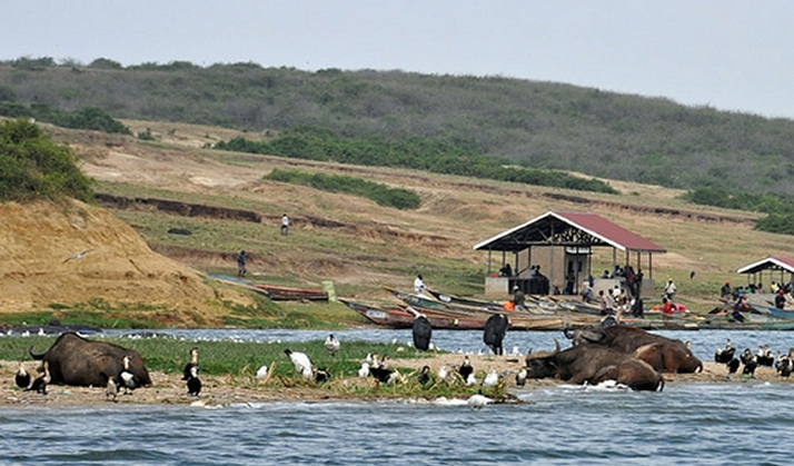
The Northern shores of Lake Edward are some few kilometers south of the Equator and has numerous primary inflows including Rivers Lubilia, Nyamugasani, Rutshuru, Ishasha, Ntungwe and Rwindi while it empties its waters to the north through River Semliki into Lake Albert. Located within Kasese District in western Uganda, the total Surface Area is this Lake is 2325 square kilometers (898 square miles) while its maximum length is 77 kilometers (48 miles), width is 40 kilometers (25 miles) and is about 112 meters (367 feet) deep. There are two National Parks bordering the shores of Lake Edward and they include Virunga National Park in the Democratic Republic of Congo (the north-western shores of the Lake) and the Queen Elizabeth National Park (north-eastern shores).

This spectacular Rift Valley Lake lies at an altitude of 920 meters (3020 feet) above sea level and is the 15th largest Lake within the African Continent. However, the western escarpment of the Great Rift Valley stands at an elevation of 2000 meters (6600 feet) above sea level rising above its southern and eastern shores that are generally characterized by flat lava plains. Tourists who visit this Lake are rewarded with the breathtaking views of the Rwenzori Mountains that are only 20 kilometers (12 miles) north of the Lake.

Just like most beautiful attractions in the African Continent, Lake Edward attracted the interest of popular European Explorers including Henry Morton Stanley who is said to have first seen the Lake in 1888 during the Emin Pasha Relief Expedition. This Lake was named after Prince Albert Edward, Prince of Wales and son to then British Queen Victoria who later became King Edward VII. However, it was renamed Lake Idi Amin by the Uganda and Zaire Government (former Democratic Republic of Congo) in 1973 after former President of Uganda-Idi Amin Dada but after he was overthrown in 1979, it regained its original name.

In the past 500 years, a number of volcanic activities were recorded within the region, with the two immense ones being Bunyaruguru Volcanic fields near a 32-kilometer long Kazinga channel on the north-western edge of the Lake and the Katwe-Kikorongo volcanic fields. Lakes George and Edward that are adjacent to each other were one of the larger Lakes in the past but the Lava that flowed from the nearby fields as well as the Maya-ya-Moto and Nyamulagira Volcanoes flowed in and separated the two, leaving the Kazinga Channel that connects the two.

Flora and Fauna within and around Lake Edward

There are several animals that live or visit the banks of Lake Edward and they include elephants, buffaloes, crocodiles, lions, antelopes and chimpanzees that are generally protected within Queen Elizabeth National Park. Not only that, the Lake and its surrounding areas are haven to numerous migratory and perennial species of birds.

Also, Lake Edward offers shelter to several fish species including over 50 species of Haplochromis, 25 species of Haplochromine, Bagrus docmak, Sarotherodon leucostictus and Sarotherodon niloticus and many others, hence making fishing one of the most important activities among the local residents.

In addition to Lake Edward, Queen Elizabeth National Park is famous for other beautiful places worth exploring that include the Ishasha sector (known for the tree climbing lions), Kyambura gorge (home to the Chimpanzees), Kasenyi Plains, Lake George, Maramagambo forest, Mweya Peninsula and the Kazinga Channel.